
 Most GIS and remote sensing specialists are ignorant of rich websites that provide free quality satellite images. So now Just for you bring to you top-notched valuable researched sources of free satellite imagery for all researchers from some relevant space agencies around the globe.
1. VITO Vision
VITO Vision is a coarse resolution satellite best adapted for large scale applications. It offers free satellite images which map out the Earth surface’s vegetation patterns. They are SPOT-Vegetation, PROBA-V and METOP. It has a comprehensible interface, but it takes quite an effort to create an account in it.
2. DigitalGlobe Free Product Samples
Free satellite imagery samples can also be found in DigitalGlobe, which ranks as the largest and sharpest commercial satellite data supplier in the world. DigitalGlobe has a reputation, delivering on their promise on imagery view beyond the human eye with sophisticated high-resolution satellites.
3. NOAA DIGITAL COAST
If you only want coastal data, there’s no better place to go than NOAA’s Digital Coast. Simply define your choice of interest and select from the range of free satellite imagery dataset such as infrared, radar and true color composite to download. You shall as well get imagery, land cover, elevation, socio-economic and benthic data.
4 . GLOBAL LAND COVER FACILITY
Looking for land cover data and land cover changes around the world? Global Land Cover Facility encompassing both geologic, agriculture, hydrologic, vegetation, and urban areas on the earth’s surface.Landcover.org is the best place to look for land cover data satellites such as MODIS, AVHRR and Landsat satellite imagery.
5. BLACKBRIDGE/GEO-AIRBUS
 Some satellites such as RapidEye, SPOT, and TerraSAR data are specific to some fields like oil & gas, security, agriculture, environment, disaster mapping, mining and energy. Blackbridge provides these specific satellites for Canadians only while Airbus Defense Systems provides for the rest of the world.Sample data can be downloaded in some of the locations below; Free RapidEye Data from BlackBridge Airbus Defense and Space Gallery Home Airbus Defense & Space Sample Imagery Web Viewer Click for More
6. The National Map Viewer and Download Platform
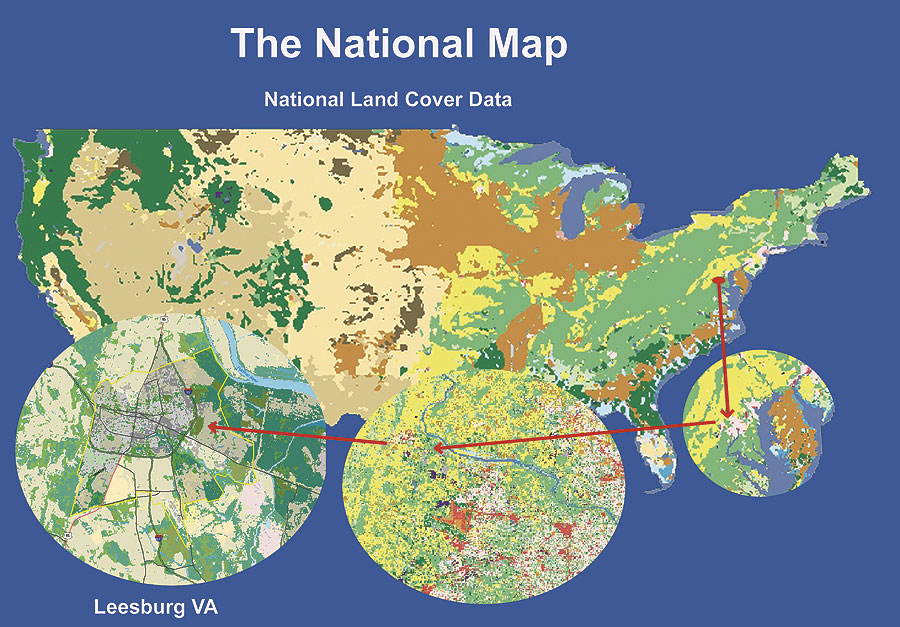 This platform setup by the USGS National Geospatial Program (NGP), is your best choice for topographic information which allows you to view and download most current topographic base map data and products for free. Users can access a wide range of data services including Maps (Download Maps, Explore Historical Topo Maps and Download, Buy a Printed Map, CSV of Map Products); GIS Data (Download GIS Data, Cloud Browse, FTP Access, Small-scale Data, Historical Data Archives, Hazards Events); Visualizations, Applications and tools. Check Topographic Information.
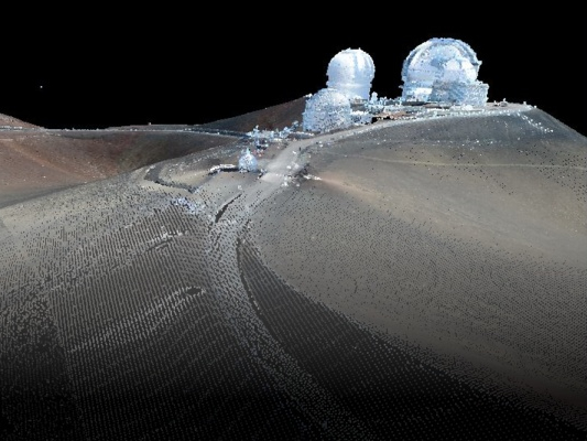 7. UNAVCO Research Data
UNAVCO is an acronym for Universities NAVSTAR Consortium, a geodesy technology research-based organization of universities. They encourage research by providing access to geodesy data such as plate tectonics, earthquakes, flooding etc.Their website, the UNAVCO SAR Archive Search User Interface is rich in Synthetic Aperture Radar satellites sources. All you need is a username and password!
8. LANCE: NASA NEAR REAL-TIME DATA AND IMAGERY
 This system provides the general public daily access to satellite images of the Earth’s observation data and imagery. LANCE stands for Land, Atmosphere Near real-time Capability for EOS. It is a NASA (National Aeronautics and Space Administration) project which supports application users interested in monitoring a wide variety of natural and man-made phenomena. Here you can access Near Real-Time (NRT) data, Near Real-Time versus Standard Products, External Near Real-Time Data, FIRMS: Fire/Hotspot data. Also available is Overview of Near Real-Time Imagery, Worldview, Global Imagery Browse Services (GIBS), Rapid Response, Hazards and Disasters.
More information about LANCE through Click for more.
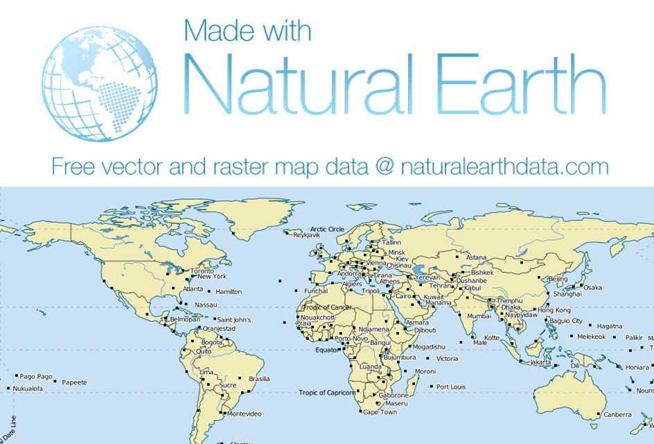 9. NATURAL EARTH’S DATA
NaturalEarth Data provides cultural, physical and basemap data at a global scale specially fitted for Cartographers. Constructed with the support of North American Cartographic Information Society (NACIS), users can download global free GIS data in public domain allowing you the privilege to modify and share data at will.
10. Bhuvan Indian Geo-Platform of ISRO
For two decades ago, India has been emerging strongly in the technology of satellite remote sensing after it launched the Indian Remote Sensing (IRS 1A) satellite in 1998. The state of the art data platform,Bhuvan Indian Geo-Platform was built for only Indian Use. All the satellites are Indians and include Cartosat, OceanSat, ResourceSat and IMS-1. Some data imagery can however be downloaded from outside India. CartoDem Version -3R1 is available for SAARC countries, Global Coverage and Climate products for North Indian Ocean. It is also provides 3 D and 2 D Images.


No comments:
Post a Comment